Category Archives: Riverside County

More Parking, Apartments Headed for Riverside’s La Sierra Metrolink Station

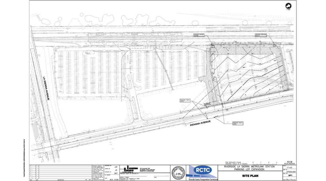
Transit and transportation agencies pay a lot to provide the patrons somewhere to store their car while they use the service, despite the dubious results, and these parking lots consume a lot of land. Yet, even in the face of oversupply, agencies continue to push forward with plans to expand parking options at stops and stations. One member of that club is the Riverside County Transportation Commission. Back in March, they took comments on a plan to add over 500 more spaces to one of the stations along the Metrolink 91/Perris Valley and IEOC lines. This expansion would occur on an agency-owned vacant lot directly adjacent the existing parking lot.

OLYMPUS DIGITAL CAMERA
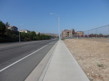
The apartments under construction as seen from the southeast. Due to the bluff, they are around the same height above the street as the homes.

In addition to the 500+ spots planned for transit passengers at the station, the Metro Gateway project is currently under construction on two other pads at the station. This development will add 187 units to the neighborhood, but despite being directly across the lot from transit, will also include nearly 300 more spots for the residents and their visitors. That brings the total number of new spots at the station up to about 800, not just the 500 planned by RCTC, an increase of around 75%.

A recent parking audit of the station found around 100 free spaces at 8:30 AM, representing an occupancy of greater than 90%. However, because there are no trains heading west between 7:40 and 10:40 and only one heading east at 9:21, it’s reasonable to assume that the 8:30 numbers represent a daily peak, though it is plausible to believe that some of those spaces might be used by students attending CSU Fullerton when the school year starts. Nevertheless, there continues to be space available and the recent opening of the extension of the 91 Line to Perris added nearly 1700 more spots to the total available in the area around Riverside.

OLYMPUS DIGITAL CAMERA
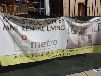
Putting up signs that say “transit oriented” doesn’t automatically make something actually transit-oriented, even when built by a train station.

Meanwhile, though it’s being billed as TOD, the Metro Gateway development would be better described as transit-adjacent development. In addition to the exorbitant amount of parking included, Metro Gateway lacks any visible signs of incorporating a mix of uses that would bring life to a site that is realistically devoid of life. While there is a retail plaza already located across La Sierra Ave. from the station where the new residents will likely be able shop as well as a bowling alley next door to the north, including some office/retail/light industrial space as part of the project would’ve been really helpful for improving the current parking crater around the station more than just some apartments will. Doing so would’ve been a great way to make the La Sierra Station more than just a pair of platforms and a parking lot, but perhaps even eventually providing space that could be used for satellite classes offered by the namesake school.

It’s disappointing to see that RCTC continues to feel that even in the heated SoCal housing market, the best use for prime land near transit with service directly to LAUS, Oceanside, Riverside, and San Bernardino is to let people store their cars to ride said trains. The biggest upside to a parking lot is that it is relatively easy to replace them with something better in the future. But still, even at present, if RCTC thinks having that much (free!) parking there is really necessary, it should be consolidated into a parking structure on the site to enable other development on the remaining parcels. The station area could easily support a vibrant community around it if only some forethought and creativity were used. Hopefully, this is a wake-up call to that end as RCTC still has several other parking lots throughout the county.

More photos of the site and project are available here.

Progress Report: Perris Valley Line

Things are ever so slowly coming together on SoCal’s biggest rail expansion of the year: Metrolink’s Perris Valley Line. The Riverside County Transportation Commission is leading the project that will add a hair over 24 miles and four more stations to the Metrolink system, an undertaking that has been in the works for decades. RCTC originally purchased the San Jacinto Branch Line being used for the extension back in 1993. They’ve sat on it since then, largely content with limiting their rail ambitions to numerous studies of all the options. However, BNSF does still service some customers along the subdivision and the portion through Moreno Valley is where some freight cars got blown over a couple years back.

Trains were originally supposed to be rolling by the end of 2015. And they were, with RCTC holding an opening ceremony back in December. Unfortunately, nearly a quarter of the way into 2016, those rolling trains still are not carrying passengers. Though trains have been running tests since October, there are still varying levels of construction continuing at all the stations; the Downtown Perris station is probably the most put together of the lot. This presents another setback for a project that has already seen it’s share of delays from studies and a NIMBY lawsuit.

In traditional suburban commuter rail fashion, all four stations are surrounded by a moat of parking, with probably at least 1,100 spaces spread among them. This is ultimately not surprising, especially since RCTC is currently embarking on a parking lot expansion at the La Sierra station, but it remains to be seen if this is really the best plan in the long term. The good part about parking is that it can be easily converted to something else and since it is already provided, perhaps the communities where they’re located will be able to leverage them to meet minimum requirements. Nevertheless, let’s have a quick glance at what has been built thus far.

South Perris

The South Perris Station is the end-of-the-line for the current extension, but the rail corridor is the one that would eventually continue on to San Jacinto if RCTC doesn’t kill it first. But since it is the current end, this site consists of not just a platform and parking lot, but several tracks for layovers and overnight storage of the trainsets. Everything at this site is still under construction including the layover yard, the parking lot, and the boarding platform. It’s probably not an understatement to say that this is the least complete of the bunch. Totally surrounded by farmland, this station is (obviously) largely designed to capture park-n-riders from places like Menifee, French Valley, and even Hemet. However, the literal absence of anything built immediately adjacent to it does provide a great opportunity for the City of Perris to leverage the transit connection to direct development there in the future. But with both an airport and sewage treatment plant nearby, there is certainly room to discuss whether residential would be the best type of development for the location.

Downtown Perris

In a direct contrast to the So. Perris station, the Downtown Perris station is probably the most complete of the four. It’s not just a stop for Metrolink, but also the hub for RTA’s operations in the area and the bus bays are already seeing use. It is located in the center of Perris directly adjacent the historic Sante Fe depot in the city and the tracks from the Orange Empire Railway Museum are being extended to provide access directly from the train station and the station itself has several very prominently featured memorials to the late Disney animator Ward Kimball.

Though this station is also surrounded by a moat of parking directly adjacent the station, there is one mixed-use development across from the station with several dozen apartments as well as some City offices occupying some of the retail spaces. Other spaces are still vacant, but that will probably change soon, especially once trains are running. There are also quite a few vacant lots in close proximity to the station and with UCR just two stops away, I wouldn’t be surprised to see some renewed interest from developers. Already, some affordable units within a half mile of the station have recently been completed and more are probably going to be on the way.

At the station itself, the pedestrian accommodations are a refreshing to see in a region that critically lacks any such provisions. However, the ped and bike connections to access the site could do with some improvement. Most egregious is likely the intersection directly adjacent the station block, where pedestrian crossing is prohibited on the leg of the intersection closest the station. Predictably, that manifested itself by way of an elderly gentleman crossing CA-74 at the rail crossing. Additionally, RCTC has unfortunately not gotten the memo on good bike parking and installed ‘wave’ racks at the station itself.

Alessandro

The Alessandro station is another primarily commuter-focused station. Since the likely ridership will come from Moreno Valley and the eastern side of Riverside, its major component is also a couple acres of blacktop to allow people to store their cars. It’s surrounded not by farmland, but by warehouses and there are a couple of vacant lots nearby too. There is also an office building or two directly adjacent the station, but it remains to be seen if the reverse commute will actually go all the way to Perris and thus be useful enough to draw ridership to use it. Additionally, there are several pads on the station site itself with signs stating their availability for building as well as empty lots across the street. Similar to South Perris, it also presents a great opportunity to take advantage of the budding transit potential with some smart development, especially given the relative proximity to the Alessandro BRT project currently being planned.

Hunter Park/UCR

At the time of stop by, the Hunter Park/UCR station was probably the second most ready for use. This station is also primarily a park-and-ride lot located in the midst of warehouses. Unfortunately, the same NIMBYs who delayed the train were also successful in stopping plans for a station that was to be more proximate to UCR itself and which could’ve provided a great anchor point for the Riverside Reconnects streetcar. It has been rumored that the station might still be built in the future, but that is a long way off from reality at the moment. The station that did get built is directly adjacent the UCR Bourne School of Engineering Annex, about a mile and a half from the main campus. Fortunately, RCTC took the forward-thinking step of ensuring that the sidewalk from the platform extended to both sides of the block where the station is located, providing a convenient cut-through of what is otherwise a half-mile long block.

This is also the most northern station and the last of the four new ones when heading west on the line. Much like the Downtown Perris station, it will be a hub for buses in the area and includes a bus-only loading zone. Since the station isn’t actually on the campus, hopefully UCR will run a shuttle to meet the trains and provide students that connection. There are also some vacant lot opportunities directly across the street that are available, hopefully the City of Riverside can guide development to those areas. Given the proximity to the school, student housing probably would be best, especially since the population generally owns fewer cars anyway. But other types of housing shouldn’t be shunned, especially since it will be one station away from downtown Riverside.

A handy feature of both the HP/UCR and Alessandro stations is their use of bioswales for onsite water management. That’s a refreshing change from the status quo in the vast majority of parking lots that rely on funneling water into gutters and drainage systems. Every bit of water that we can not send down the river soon as it hits the ground is beneficial to a region that is still in a drought. Such seemingly little things can have a big impact and hopefully this is indicative of a new approach to water management.

That’s it for now. At a future date (likely after service begins), I’ll take the time to delve into each station individually. Meanwhile, many pictures of the current state are available here.
Is RCTC Purposefully Killing Rail Transit to the San Jacinto Valley?

Earlier this year, the Riverside County Transportation Commission joined several transportation agencies around the state to gripe about the uncertainty of revenue projections due to the recent gas tax swap formula that has resulted in a lower gas tax this fiscal year. This should come as no surprise, as the vast majority of Riverside County’s Measure A funds are being poured into building wider roads throughout the region. With only 15% of the money dedicated to transit, it should be imperative that they do everything possible to stretch those dollars.

riversiderail
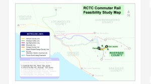
A screenshot of the map included in the 2005 Riverside County Commuter Rail study shows potential routes and options for rail service. Image: RCTC, edited by author.

Although Measure A sends the vast majority of revenue raised toward building wider roads, Riverside County voters also expected some increase in rail service when they voted to reauthorize it in 2002. In 2005,  RCTC delivered a report on some options for increasing rail connectivity in the county. Out of that report, a further (peak commuter-focused) extension of the currently ongoing Perris Valley Line extension an additional seven miles east to Hemet/San Jacinto* was rated very favorably. That extension would also serve an area similar to that of the planned Mid County Parkway, potentially reducing the need for RCTC to build another freeway through the center of a disadvantaged community.

However, buried deep in the Environmental Impact Report/Statement for the SR-79 realignment is a ticking time bomb against the prospect of rail service ever reaching San Jacinto. In 2013 [PDF, page vi (12)], the report had this to say:

The design options would include a near-grade crossing over the San Jacinto Branch Line with embankment and structural section for SR 79. The near-grade crossing over the existing railroad would be approximately 0.9 to 2.4 m (3 to 8 ft) above grade. (Emphasis added.)

In other words, at the point where the realigned highway would cross the railroad, it would be at a height of less than ten feet above the rails. This dismal synopsis was repeated in the Recirculated EIR/EIS [PDF, page 3-167 (243)] that went out earlier this year. For those of you keeping track at home, no trains can fit under bridges that low (not even a manned rail rider on the shorter side). Section 9.1 of CPUC General Order 26-D says that it’ll be at least six feet too low and based on Metrolink’s dimensions (PDF, page 3), their equipment needs a minimum of 16 feet of clearance above the rails. (Metrolink is the logical service provider for this extension as they would already be operating to Perris.)

So in short, despite the fact that RCTC already identified the San Jacinto extension as being one of the most viable and cost-effective options for rail service expansions in Riverside County, RCTC already owning the line, and RCTC leading on the SR-79 realignment project, RCTC did not stipulate that their own freeway construction would need to provide adequate clearance for any future trains that they would plan on their own tracks. That is a breakdown of colossal proportions.

Further on, the report does acknowledge that rail transit has been considered on the corridor. However, they consider constructing overpasses to make sure that train service on an existing line remains viable to be the responsibility of the rail project, not the responsibility of freeway that is severing the rail access:

In the future, if a separate project is developed that adds passenger rail service, a grade-separation project would need to be considered.

In short, RCTC is shooting a worthy project in the foot. The only question is are they doing it on purpose or is this merely a (massive) oversight? Unfortunately, we may never know. However, Caltrans does still have to issue final approval and building a(nother!) freeway runs counter their recent admission that building freeways doesn’t help traffic at all. Instead, Caltrans needs to be more proactive about alternatives, in this case by putting their foot down and not allowing a viable rail transit line to be severed by a freeway. (They really should go a step further and require that the rail extension to Temecula via the SR-79 alignment that was also identified in the RCTC rail study to be built concurrent with the freeway.)

Failure to do so makes it much harder for the all levels of government to meet legislative goals focused on reducing GHGs, VMT, and disparate impacts of transportation dollar allocations, especially in the Inland Empire. Cities along the route of both freeways (realigned SR-79 and the Mid County Parkway) are already looking forward to the freeways “spurring development”, but injecting two new freeways into the San Jacinto Valley without also upgrading transit is all but guaranteed to ensure that no TOD will be built. Instead, there would be more sprawling development in what is already one of the most sprawled regions of the country [PDF]. That doesn’t have to happen, but it requires Caltrans and RCTC officials doing the right thing and lead.

*For those who may feel tempted to call the area rural, including its own residents, remember that were it not for RCTC and SCAG, Hemet alone is populated enough to require its own metropolitan planning organization under federal law and San Jacinto is really close.

What If: Priorities

Where do your community’s priorities lie? That’s a question that we should all be asking ourselves as we prepare to make infrastructure investments that will have an effect for decades into the future.

Nowhere is this more evident and important than in our transportation decisions. In many communities, the transportation network rests on a backbone of arterial roads. However, decades of

A typical arterial cross-section being used in many newer developments all around the country dedicates all space to cars.
A typical arterial cross-section popular in the region dedicates the majority of space to cars.

car-centric planning and design have resulted in facilities that are increasingly referred to as “stroads“. They’re not good streets, but they’re not good roads either and in the end, everyone gets the short end of the stick. The result is a facility that suffers from “peak hour” congestion and that doesn’t serve those who aren’t driving.

But there’s a better way. With a little shift in thinking, it becomes easier to design a transportation network that is good for the mobility of all, whether they be on a bike, in a car, walking, or using transit. When viewed as a corridor and principles of complete streets are applied, these facilities can be optimized to provide maximum movement of goods and people, not just cars.

An arterial dedicated to moving people takes on a different form.

With that understanding, it becomes evident that the current system is grossly inefficient and needs to change. But what does the alternative look like? Using the same room as before, a redesign of the corridor assigns each mode its own dedicated space optimized for its specific travel needs. Cars and trucks don’t slow down transit, transit doesn’t block lanes to load its patrons, and bicyclists are free to pass along on their own separate path optimized for biking. For roads that access industrial facilities, it can even be tweaked a bit more to offer a dedicated truckway in the corridor that is reinforced to handle the axle loads of trucks.

Far from just musings, this design is in use already in The

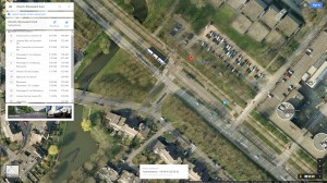
Archimedeslaan in Utrecht includes a roadway for motorists, a busway (bus times shown), and a bikeway.
Archimedeslaan in Utrecht includes a roadway for motorists, a busway (including a bus information screen at stops), and a bikeway. This corridor has the capacity to move triple the amount of people as the “Major Arterial” above.

Netherlands, where mobility in numerous cities is provided for all in a manner optimized for their needs. The same model can be used in the existing cities and especially new developments here in the Inland Empire. Instead of building the biggest roads today in anticipation of “future demand”, they can be built with all modes in mind in a method that greatly increases the efficiency of all the systems for all.

This is vitally important as despite hundreds of millions of dollars spent, the transportation infrastructure in the Inland Empire region has shown no improvement in recent years, barely maining a D+ rating in both the 2005 and 2010 assessments from the local branch of the American Society of Civil Engineers, but requiring  a whopping 67% increase in annual investment during that time. If we are going to ever truly see signs of improvement on not just the roads, but many other local issues, there needs to be some real change in priorities. Switching the focus to the movement of goods and people over just cars will set the Inland Empire up for a more robust and resilient future.

Facing Funding Shortfall, Riverside County Presses On with More Roads

Even as Riverside County officials bemoan the recent downward spike for repairing roads in revenue, they’re digging in and getting ready to fight for a $1.7 billion, sprawl-inducing, LOS-based road expansion project after a lawsuit was filed to stop it last week. It is but one part of a long list of other expansions that the folks in Riverside are currently working on that will add hundreds of lane-miles to a heavily car-centric transportation system that is already just two steps above failing.

The general footprint of the Preferred Alternative for the MCP would pass within mere yards of three schools in the City of Perris. Image: Google Maps.
The approximate footprint of the Preferred Alternative for the MCP would pass mere yards away from three schools in the City of Perris. Image: Google Maps/author.

In an ironic twist or perhaps an apology in advance for its impacts, the project has been dubbed the “Mid County Parkway”. Current plans call for it to head east from I-215 through the City of Perris and terminate in San Jacinto, 16 miles away. Along its course, it would route a projected 80,000 or more vehicles a day to within a stones throw of several sensitive receptor sites, including some  elementary schools and parks. In addition to being more than double the current counts, a significant portion of that number would likely be some of the 14,000 or more trucks a day accessing warehousing sites like the World Logistics Center that are currently proposed or under construction in the area. The construction of the freeway would also disrupt [PDF] a couple planned healthy transportation corridors [PDF] without providing any acceptable mitigation.

With the certified Final Environmental Impact Report in hand as of their April board meeting [PDF] and barring any action by the courts, the Riverside County Transportation Commission is hoping to soon begin design work and the acquisition of any properties in the way of injecting a six-lane freeway through the heart of some of the poorest neighborhoods in Riverside County. In an all-too-familiar narrative, this planned freeway has been curtailed. Earlier plans [PDF] called for it to also extend 16 miles westward to connect with I-15 near Corona, but those appear to be shelved for at least the near term after opposition from residents [PDF] of the more affluent communities along that route.

Meanwhile, despite high demand by Riverside County residents in the area for more transit options, decade-old plans to extend the Metrolink [PDF] Perris Valley Line (and potentially other rail transit services) to the very same San Jacinto along an existing rail continue to languish. Not only would that project achieve the same goal at a vastly lower cost than building the MCP, it would also help contain growth in the area that is threatening farmlands and open space. As Caltrans seeks to realign toward being more multimodal and develop an inclusive transportation network, their biggest hurdle may not come from within, but from other agencies proposing projects like this.

Weekly Review

With a new year comes new plans and development. As we head into the second full week of the year, a lot of exciting things are already shaping up for you to get involved in. Here go a couple.

Jurupa Valley General Plan
The City of Jurupa Valley is holding several meetings concerning the completion of an Interim General Plan.

The City of Jurupa Valley has had a challenging history in its short life. Right after coming into existence, Jerry Brown yanked a major funding source from them and there was concern that the City might be quickly dissolved back into a pocket of Riverside County. Nevertheless, they’ve managed to survive and as they look to celebrate a fifth birthday soon, they’re al looking to become more permanent and want to plan what they’ll be in the future. The City is looking for guidance and input as they seek to develop an Interim General Plan. They will be holding several meetings over the next four weeks, so check out the list [PDF] and attend the one that works best for you.

Perris Optimus Logistics Center DEIR

TODAY [PDF] is the last day to submit any comments you might have to the City of Perris that pertain to the planned Perris Logistics Center in response to the Draft Environmental Impact Report [PDF] for the project. In typical fashion, the plan is to scatter stoplights, dedicated turn lanes, and other similar “improvements”. Stuff that is patently bad for bicycling. Of great concern are the intersections where the roads will balloon in size. That’s not good for speeds and definitely not good for fostering a comfortable riding environment.

But even more concerning is the callous disregard for the City’s Trails Master Plan [PDF], which includes bikeways on many of the streets identified in the EIR analysis as needing widening improvements. What’s more, the traffic analysis was done by the same consultant group that did the Trails Master Plan. It seems like they should have the files on their computer still since the City approved it not even two years ago. All they had to do was look back at the document to realize “oh crap, maybe this isn’t a great idea” for the majority of the stuff that they put in the Traffic Analysis of the EIR.

No surprise, that conversation apparently didn’t occur and without robust standards, we have to fight to get anything beyond BIK LANs next to an expressway. Hopefully, Caltrans develops competent standards for Class IV cycletracks, especially for applications when one is necessary versus using a painted Class II lane. The VMT-based traffic analysis standards are also something to look forward to and will hopefully help alleviate this kind of nonsense for future projects.

Share Info!

That’s all for today, but there’s almost certainly more going on. If there are any projects or planning that you know is occurring, get in touch and share it! One that we’re looking out for is the  Draft Environmental Impact Report for the forthcoming World Logistics Center project that is under consideration for the City of Moreno Valley. That document is due within the next month or so. At that time, it will be interesting to see what comes out of that as far as traffic mitigation goes, though history hasn’t shown the consultants who do most of the traffic analyses for this area to be particularly inclined to do anything beyond throw around traffic signals and turn lanes. But we’ll see for sure soon. Until then, ciao!

Update: The City of Chino is also preparing to prepare an Environmental Impact Report for a project being dubbed the “Brewer Site”. More information on that project is to be found at the link above. This is an exciting new time for projects like this since the traffic impacts must now  be evaluated using VMT instead of LOS and plopping houses in the IE for people to drive to LA/OC/(SD) will require far stronger mitigation measures for local trips and really an opportunity to get some innovative new solutions. So check it out and get some comments in, even if only a few lines.

The Festival of Outrageous

Riverside’s Festival of Lights is an annual event that draws tens of thousands of people downtown to see it. In addition to the lights, there are other attractions including shops, Santa, and an ice skating rink. It’s so popular that it was voted the best public light display this year by readers of USA Today.

While the lights were pretty, the way the influx of people was handled was not. This year, Mission Inn Ave. that borders the Mission Inn was closed and Main St. has been pedestrianized for years. Thus, there was no problem at the intersection of Main and Mission Inn, which is normally a signalized crosswalk. However, University Ave. remained open as the vehicular access through the area. It also has a signalized crosswalk and it was strained to the max.

This video showed up of the City’s comical, yet sad response to the situation. Instead of adjusting the timing to give pedestrians adequate time to cross (or even just closing it completely), police are out enforcing “crosswalk safety” by way of publicly shaming those seeking to cross the street. I guess we should be glad that they didn’t stoop all the way to the level of the LAPD and start ticketing people entering the crossing once the hand and countdown started. Still, it is a telling sign of the culture of the City, which is one of the anchors of the region with the worst pedestrian safety record in the state. Stuff like this shows why that is.

Weekly Planning Review

It seems that all that gets talked about here is plans. Well never fear, I have no intention of disrupting that cycle now. There are several more chances to provide your input over the coming days. Here goes.

Metrolink (SCRRA)
Metrolink future scenario S2.
Metrolink provides a tantalizing vision of a possible service scenario over the next decade. Image: Metrolink.

Metrolink has released another survey seeking more input on their 10 year strategic plan. This plan is the driving force behind what they do over the next decade or more, so it is imperative that it include forward-thinking planning now to make a better system tomorrow. They of course have all the questions that one would expect from a survey of this nature, but please take the time and go answer them.

One of the top results of an earlier survey was that the people want to see more service and that it come by more frequently. Metrolink has prepared several scenarios with a general summary of both the stations and frequencies that would be in place. By far, S2 (pictured above) is the most ambitious option of the lot as well as the most helpful to the IE and should definitely be supported. It includes the extension of service into Santa Barbara County, two branch extensions of the Perris Valley Line, Metrolink extension as part of the Redlands [Passenger] Rail Project, and a spur down to KONT.

There are also some improvements to service time, with trains coming as frequently as 15 minutes during peak hours between San Bernardino and Ontario and between Riverside and Corona West. However, eastern connections are not as good nor convenient, so the plan should be tweaked a bit. It is becoming increasingly common for people to travel wholly within the IE for work and pleasure, but S2 still focuses a few too many resources on getting people to get to DTLA instead of between San Bernardino and Riverside Counties.

Altair Specific Plan

The City of Temecula released a Notice of Preparation [PDF] a couple weeks ago for the Altair Project (which was also apparently known as “Village West”). It is now coming down to the last few days as comments are due by December 15. The plan would just under 1800 homes on about 200 acres directly west of Old Town Temecula, right at the base of the hills. The Initial Study does acknowledge that the Project would likely have Potentially Significant Impacts to a rather substantial number of metrics on the CEQA list, so there are really plenty of bombs to lob at it. Of course, they’re doing a CEQA review for precisely that reason, to find possible mitigation measures for all those potential impacts.

Though unlikely, stopping it would be nice. Short of that, the biggest and most effective thing that could be done to tame the project would be to require that the Transportation & Traffic analysis be done pursuant to the VMT-based CEQA rules that are being wrapped up. If you submit a letter asking for only one thing, let that be it. Though the Project is dressed up as a “primarily residential mixed-use community”, it is unlikely that the immediate area would provide jobs for those inhabitants, so daily VMT due to the project would still grow.

Planning for cars should kill it because a traditional LOS-based traffic analysis will drop a load of widened streets and longer signal timings, but we all know better. By contrast, the only way to counter a VMT-based analysis would be to actively discourage people from driving short distances because they’ll almost certainly be driving long ones for work. That would meant that stuff like getting the Murrietta Creek Trail completed, cycletracks on the Temecula Parkway/Western Bypass, and direct bike/ped connections between each of the “villages” in the Plan, but not driving access (maybe even make them into “woonerven”). There also needs to be a direct connection to all school so that kids wouldn’t driven to school.

Well, not that much this week. The holiday probably has something to do with the dearth of documents to be reviewed, but the opportunity to be heard is still very much open.  Make sure that your voice matters, and this is a great time to put that notion into action. With a little planning and foresight, the Altair Specific Plan could provide a model of how things are supposed to be moving forward instead of being stuck in the past. But, that’s all we can do beside sit down and watch. Get yours.

Play Time!

The Inland Empire needs more opportunity for play. Image via Worakit Sirijinda on freedigitalphotos.net.

Recently, KaBOOM! released the Playful City USA 2014 list of cities and it contains a couple of bright spots here in our very own Inland Empire. Several area cities have received Playful City USA designations, some multiple times. (Record is Riverside with seven.) This is great news not only because it adds a feather into the cap of the respective communities, but also because it means that the community is coming together to actually do something to improve the living environment for its residents.

Communities on the list are working hard to provide more for their residents, as exemplified by a recent KaBOOM! playground build in San Bernardino. KaBOOM! partnered with Dr. Pepper Snapple Group, the City of San Bernardino, and dozens of volunteers to build a playground built in a day (video below).  The new park is located near downtown and is directly accessible from where the legendary Route 66 passes through the City.

This is a great start, but we need more. The Inland Empire is in dire need of places and parks are a great way to accomplish that for very little money. As a result of winning the sprawl competition, thousands of acres sit devoid of life, driving wedges between our communities. Yet, relatively small changes to those spaces are all that are needed to make things better. These humble efforts can have big effects on livability, such as the move by Redlands (which isn’t even on the KaBOOM! list) to pedestrianize an alley and provide human-scale furniture to encourage a livable space in the city.

Other opportunities abound in the region and are just waiting for rejuvenation by the community. It doesn’t take much to bring life to a drab slab. A couple of tables and chairs can create an inviting environment. A pocket park can do wonders to a dejected corner. Let’s stop wasting time. Let’s play. Yes, even (or perhaps especially) the adults.

Weekly Regional Roundup: Support Better Biking from the Beginning

In recent weeks, there’s been a flurry of activity in the planning arena toward making things better in the Inland Empire. In addition to the start of construction of the Pacific-Electric Trail Extension into Rialto, various agencies have other projects in some stage of planning that could certainly use some guidance to make sure the best possible stuff ends up being built. Here’s a chance to find out about what’s going on and where to direct any ire or admiration.

Menifee

The City of Menifee has released a Notice of Preparation of a Draft Environmental Impact Report for the Cimarron Ridge Project. To put it mildly, it needs help desperately. The City’s Circulation Element of its General Plan endeavors to develop a bikeway/NEV network that would allow (and even encourage) residents to not drive within town, yet the proposed project doesn’t include adequate accommodations toward achieving that goal. This is a great chance to get a sprawling development somewhat tamed from the very beginning. Anyone living in Menifee or having an interest in the area or project should make sure that they provide comments now so that they can be addressed by the EIR. Speaking of EIR, there is a glimmer of hope because new rules are going in concerning how traffic impacts are considered under CEQA. This project offers a great opportunity to put them to the test to improve an area that has thus far developed into a textbook example of auto-centric sprawl. Notice of Preparation for the EIR is here, Cimarron Ridge Initial Study is here. Both are PDFs. Follow the links to retrieve the relevant documents and remember to get comments submitted by September 18.

SanBAG

SanBAG‘s Draft Environmental Impact Report/Environmental Impact Study for the Redlands (Passenger) Rail Project was released in mid-August and is now available for inspection and comment (information on how to comment), which are due by September 29. The Project has been in the works for well over a decade and is part of the larger transit improvements that San Bernardino has seen in recent years such as sbX. The RPRP will reconnect a bit of the south eastern portion of the historic Kite-Shaped Track network of Santa Fe. The eventual plan many decades in the future would continue the loop up through Highland and then west along 3rd St. past KSBD and back into San Bernardino proper, but that is years away and this EIR/EIS only covers the portion from the Transit Center in downtown San Bernardino to the University of Redlands. The Orange Blossom Trail will also be very near to it in some places, offering a multimodal experience similar to other rail-with-trail projects such as SMART in the Bay Area. The EIR/EIS is available here. There will also be a public meeting at 5:00 PM on Tuesday, September 9 at The Hotel San Bernardino in San Bernardino. Take the time to at least skim through the documents and gain a little insight.

Redlands
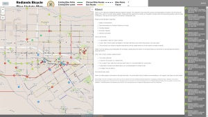
Redlands_BMP_Map
This map allows for easy input on ways to improve the biking environment in Redlands.

The City of Redlands is also seeking input for updating their Bicycle Master Plan. Passed earlier this year, it left some things lacking and people spoke up about that. The City apparently has listened and has taken a step toward improving things. While the finished result has yet to be seen, the interface is definitely a winner. It’s comprised of a map accessible from the City website that allows residents to input their recommendations for bike lanes, off-street paths, bike parking, and protected bikeways directly onto it. But best of all, other users can comment and vote on the recommendations that are already there. If you live or bike in Redlands, definitely head over to their website and check it out! Comments are due by September 25.

RTA
RTA_public_meeting_changes
RTA has added several meeting times to allow customers more and better opportunities to preview and make comments concerning the proposed changes.

Riverside Transit Agency is preparing for the future in a big way as well.  As the transit agency the serves Western Riverside County, they have a tall order to fill since a lot of the region is comprised of classic sprawling developments plopped along the freeways. There are many things to look at in their (Proposed) 10-Year Transit Network Plan and are now seeking public input on it. There are of course some winners and losers. Some routes are being realigned to meander less, which inevitably means that some stops are being taken out. RTA maintains that almost all customers will still be within 1/2 mile at most of a transit stop, but it’ll nevertheless be a tough pill to swallow for those who are used to having a bus stop right next to their porch. One way to greatly lessen the pain would be to make sure they support better bikeways, especially to major hubs. Also, high-quality bike parking at least at stops serving intersecting routes and major destinations can go far toward providing for those who are undoubtedly multimodal.

However, all routes are having service improvements and will all be at least 60 minute frequency. Currently, some are over an hour between buses. That 15 minute improvement makes missing the bus slightly less inconvenient.  At the other end, some routes will have frequencies approaching BRT status. Additionally, there are more indications that they might definitely be heading in a BRT-lite direction for Route 1 with both a limited stop option as well as signal priority. Of course, a decent portion of Route 1 is substantially identical to the proposed Riverside Streetcar, so it is imperative that RTA follow along with that conversation so that improvements could benefit both systems. Final comments on the entire plan are due to RTA by September 19. Access to a copy of the proposed changes is here [PDF] and a copy of the meeting notice is included here (PDF, identical to picture above).

That’s all for now, folks. If there are any other projects going on in the area, feel free to share more info so that others can add comments. There is of course quite a lot going on in the region and some stuff will undoubtedly slip under the radar without vigilance.